For many moons I'd been hearing little tidbits here and there about the North Umpqua Trail, a rather long trail that winded along a river in South Western Oregon. Something like the Mackenzie River Trail, but supposedly bigger and better. Lots of tough sections, and great scenery, etc. Ok I guess it should be investigated. After last weekend's successful uber-long ride, I reckoned that the 80 mile Umpqua trail would go down well for a 2 day weekend ride. I bought a map, did a little research, and it seemed like a good idea to camp around the middle of the trail, then the first day do an out-and-back in the uphill direction (around 35 miles 1-way, but maybe turn around after 25 miles or so), then the second day do a 45-mile shuttle ride in the downhill direction. I proposed this to the Sorenson Gang, and they readily accepted.

Friday night we met up at Toketee Lake campground, which at first seemed like a nice spot : campsites about half-full, lots of families and miscellaneous travellers, and only $7 a night. Well that first night sucked, as there was 1 group of campers who kept us up all night. Everything seemed fine at 11 pm when we hit the sack, but I was awaked shortly before 1 am by the sound of loud trucks unloading crap, the chopping of wood, and loud talking. Ok, some late arrivals, no big deal, and an hour later the truck departed and it was relatively quiet. But then an hour later, back it comes, more wood unloading and chopping and noises, and this went on all fucking night. Now, it wasn't the loud music, screaming yahoos type of noise that would make you yell "Shut the fuck up !", it was just a continuous stream of minor noises that prevented restful sleep.

The next morning, Chris surmised that it must be meth-heads who couldn't sleep, and just kept their fire methodically burning all night while what little brains they had were bouncing around inside their heads unable to sleep. But later we noticed that it was just a conglomeration of fishermen, kids, etc. Whatever. But obviously ignorant oblivious people who had no clue how their actions were affecting others. We also concluded that saying anything to them would be useless, as the type of person who would commit such unneighbourly transgressions would be incapable or unwilling to admit it or ammend their actions.

But hey 1 night of no sleep is never a problem, and off we went at 9am on the day's adventure. We found the trailhead across the bridge at one end of the campsite, and in no time were swooping up and down a buff trail along the river, with massive old growth. It was a non-stop rollercoaster, with short steep climbs, and awesome high-speed descents. Many pictures were taken of giant trees, until I guess we finally got used to them. However one 7-foot diameter specimen stopped us in our tracks for more tree-hugging pix. We were on the Hot Springs segment of the trail, which ended at a campsite with another trail that I guess led to some hot springs - go figure. And then we commenced the Dread And Terror section, so named by early explorers who found the river and its steep thickly forested banks so impenetrable, they were like terrified and dreaded it. This was a long 13-mile section, that traversed high up the bank of the river, and passed through many different vegetation zones. There were also a bunch of wet sections here, due to streams emptying down the slope to the river. Some of the climbs were long and steep, but with rewarding downhills.


Finally arrived at Lemolo Lake, which was a good turning around point. We circumnavigated the lake, and had lunch at a camping area which bordered a foul algae-infused section of the lake, with signs proclaiming the water as 'unsafe'. Hmm, not what you'd expect at a high-altitude lake in the middle of nowhere. But these algae blooms are not uncommon in some of the shallower lakes, and appear to be naturally caused. We had almost run out of water at this point, but waited until we saw a clean stream emptying into the lake before we refilled.


At this point, we could have returned the way we came, but the map showed what looked like a cool trail that followed the ridge way above the Southern edge of the river, so we opted for that. Found the faint trailhead out of the corner of my eye after several wrong turns, and it looked like it hadn't seen any use for years. Followed it for a bit, with the aid of some pink ribbons, but eventually it became even fainter, and we abandoned. Now it appeared too long to go back the way we had come via the lake, so we flew down a gravel road for 5 miles or so. Then we checked out the opposite end starting point for the trail we had abandoned, and it was in much better condition on that side, but left it to explore some other day. Dropped back into the Hot Springs section back to the campsite, and finished the day with another great rollercoaster ride.

Day 1 total : 8.25 hours, 4380 vert ft, 41.8 miles. What a blast ! Now for some beer and grub, but first...

Well we had decided before we got back to the campsite, that rather than risk another sleepless night, we would change sites, or maybe even abandon the campground, and find some other place to camp away from the ignorant obnoxious masses. And as if to affirm our decision, our arrival back at the campground was punctuated with the sound of loud music and screams, emanating from several different locations. Trucks full of rednecks drinking beer patrolled the campground, many of them already shitfaced at this point - it seemed like it would be a freaking warzone here tonight, and we immediately decided plan B - get the hell out of Dodge - was the only option. We'd passed one area on our ride back - Thorn Prairie - which while sounding uncomfortable, had seemed like a great out of the way place to camp. Looking around at the numerous vacant sites, it appeared many others had come to a similar conclusion. Did I mention there was also a faint electronic hum that pervaded the entire camping area ? Emanating from some nearby power station no doubt. On out trek up the riverbank we had heard it at an amplified level in some spots.

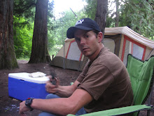
Within an hour we had packed up and made our exit, and drove up FS 3401. I noticed a sign to Oakridge along the way - possible shortcut ? And then we passed the source of the electronic hum, coming from some maintenance building - and right beside it, several houses - hmm I wouldn't want to see what mutated specimens lived there :) Just a few miles into our escape journey, we crossed a bridge, and I observed what seemed to be like a perfect campsite along the river. We checked it out, and it seemed like Nirvana : nice rushing river sound, huge open space to pitch tents, and firepit with grill. The only drawback was it was a bit close to the road, but not exactly a high traffic area I would think, so we parked it and setup. Finally got to the beer and chow, and it went down very nicely in the new surroundings. There was a bit more traffic than expected on the road, and one redneck-mobile with screaming yahoos, but other than that quiet after 10 pm, and we all had a good night's sleep.


Day 2 was to be the easier day : a predominately downhill 45 mile ride along the river westward. We dumped a car down at the bottom at Swiftwater Park. The 1-way drive time was 45 minutes, and as we drove back to the start point, the enormity of the journey we were soon to embark on hit us with full force. The river was in an immense canyon most of the way, and often you could see the trail undulating along the edge of the steep bank - sometimes down by the water level, other times hundreds of feet up the wall. Then it would disappear as the wall became too sheer, taking some other route through the surrounding mountains before reappearing again. When I first pictured the Umpqua Trail, I had imagined a meandering little river with a trail running alongside it - sure it would go up and down a bit, but never more than 50-100 feet from the river. But the reality is that this trail is Seriously Big. It's like seeing the Rockies for the first time, when all you've previously known are low rolling hills.
With all the shuttling, and packing up camp, we only get started shortly after 11 am. We are figuring on an 8-hour ride, which should leave us about an hour of daylight. I pack a headlamp just in case.
The first section we tackle right out of the campground is Deer Leap, which starts with a long steep climb, just the thing to wake you up and realize that there might actually be some work involved in this 'downhill' ride. After much grunting up and down, high above the river and around deep ravine stream crossings, we arrive at what appears to be the top of the climb for now, and are greeted with an amazing view of the river canyon and surrounding mountains. The terrain here is very dry and desert-like with the Southern exposure. We start the descent, and soon encounter a common denizen of hot dryish climes : a rattlesnake ! I must have disturbed it as I went by, and hear a commotion behind, with the words "Snake!" being clearly discernable. Supposedly the rattler took a strike at Walt as he went by, and Chris, following close behind, ran over the snake. We get off our bikes and head back up the trail to find the reptile - not hard to do, since the rattle could be heard for quite a distance. He was coiled up a few feet off the trail, ready to strike again. He seemed OK, and we took a few pix and were off.

What followed was probably one of my top 5 downhills of all time - as someone else put it "zippy, woo-hoo kind of stuff". I could add a bunch of adjectives, but you probably get the point. After a while, hit a road, and a closed sign on the continuation of the trail on the other side. I'd heard about this closure, some kind of dam work, so down to the highway for 5 miles of blacktop - at least it was mostly downhill.

Then over a bridge to the South side of the river. At this point we still had 5 sections and 34 miles to go. The next few segments sported a variety of terrain and scenery. Flat smooth rollercoaster sections, technical rock gardens, steep exposed areas, lush green stuff, and everywhere Big Trees. I've never seen so much old growth on a trail in my life. Oh, and also I should mention - no people ! If you crave solitude, this is your place. And if you're hoping to bum a tube off another biker - forget it - we saw 3 other bikers in 2 days, and one of them wasn't even on the trail.

We got to enjoy the Calf Segment, reopened this year after 3 years off the map due to fire damage - lots of brand new bridges, and great charred landscape vistas.

The afternoon wore on, and still we were far from our destination. The endless climbs of small and large proportions were starting to take their toll, and I admitted to being a bit tired. Still enjoying the awesome trail, but eager to be done as well. With 20 miles to go, we had our first 'mechanical', with Spence flatting out - he was running Stans tubeless, with a flyweight tire that was barely able to plug up after a protracted period of Stans'ing (rotating the tire around so the goop plugs the hole, pumping up again, etc.). Finally got going again, and made it through the second to last section, a fairly flat one that skirted the river edge. One especially notable bit was a hand-built rock crib section that flared the trail out over the river.

And now we arrived at the start of the Tioga section, the final link in the chain, but described as the most physically demanding section : 16 miles long, with 2 major climbs. We got freaked out looking at the numbers on the trail map : supposedly 3500 vf of climbing in this section. Had to be a misprint, right ? But looking at what we'd already been through, it seemed possible. I made a note of our elevation gain so far - 2940 vf - to see if this crazy number was right. Right at the start, Spence flatted again, and after farting around for 15 minutes trying to plug it without success, we decided to slap a tube in there. Guess what, 4 bikers, 8 tires, and only 1 spare tube ! I handed over my tube, with the caveat that I wanted it back if I needed it. But as soon as I saw it get all slimed with Stans, I knew if we punctured that baby, none of my quick patches would ever stay on.

On the road again, and it was starting to get a bit dark in the deeply forested parts. Finally after 8 miles in, we hit the famous Bob's switchbacks - our last big climb, and then downhill after that to the end. If we were going to get some vert, it would be here. I started first up the winding trail. The switchbacks were well engineered and I was cleaning them. Some of the bits in between were ridiculously steep, but I was determined not to get off the bike. It was amazing, that after 2 long days on the bike, I still felt incredible power, and was making it up stuff that would have given me a hard time after a few days rest. Got to a steepish rocky traverse, and lost it when a boulder appeared in the middle of the trail. Walked for a bit, then back on, and made it up the last few switchies to the top. Behind me I heard a shout from Spence, but didn't want to disturb my rythm and look back. Well, I think I blew my wad on that last climb, and was starting to feel woozy. So chow down on yet more sticky power blocks and gels, and guzzle more stream water that hopefully wouldn't leave me sick in bed for a week. Spence shows up and I see that the sole of his shoe is clipped into his pedal, but the rest of it is no longer attached - complete separation - not a bad time for this to happen I guess, with 5 miles to go and mostly downhill.


The rest of the crew arrives at the top, and it's clear sailing through the rest of the trail. It gets wider and wider as we get closer to the end, finally it's gravelled, then paved, and we're done. Cross the bridge and back to the car, where near-beers are guzzled and 'we did it' pix are taken.

The totals for day #2 : 8.5 hours, 43.5 miles, 4839 vf.
Is that enough riding for a while ? Well, the conensus was that now we should try to do the whole trail in 1 day : 80 miles, ~9000 vf, probably 14 hours of riding... yeah that's doable.